|
|
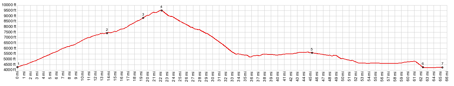
1.(00.0m,4260ft) START-END North-1:Steens Mtn Loop Rd crosses Blitzen river at campground turnoff
2.(13.8m,7410ft)turnoff to Fishlake and its campground
3.(19.3m,8850ft)turnoff to Kiger Gorge viewpoint
4.(22.3m,9550ft)TOP: turnoff to East Rim viewpoint and Steens Summit
5.(45.0m,5590ft)profile turns right onto paved Or205
6.(62.3m,4210ft)profile turns right onto Steens Mtn Loop Rd
7.(65.3m,4260ft)START-END NORTH-2: same as point1
|