|
-
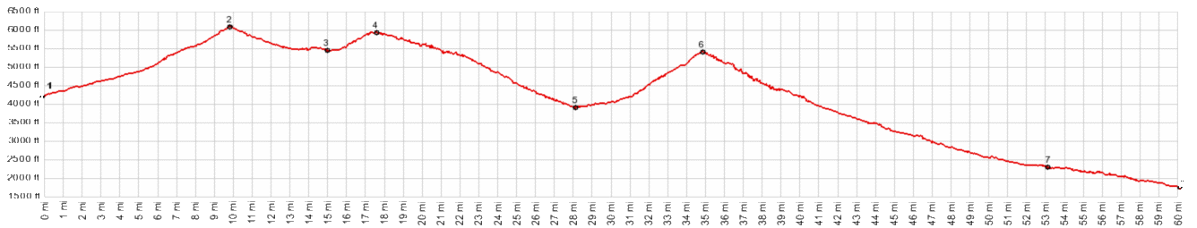
1.(4220ft,mile00.0)START-END
WEST: jct Wa350-Wallowa Mtn Rd
2.(6070ft,mile09.9)TOP: Salt Creek Summit
3.(5440ft,mile15.0)intermediate low point
4.(5920ft,mile17.5)intermediate high point: FR39 -
3930(sh)
5.(3900ft,mile028.0)low point at jct with upper
Imnaha Rd
6.(5110ft,mile36.1)FR39 s(u)-2
7.(2300ft,mile53.0)profile turns left onto Rte86
8.(1790ft,mile60.2)START-END EAST: bridge over
Hell's Canyon
View Or_salt_creek_summit.gpx in a larger map |
-