| |
|
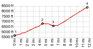
1.START-END EAST:just south of western
I80 exit to Wells
2.intermediate high point,6840ft
3.turnoff to Angel Lake NF campground
4.TOP: end of road at Angel Lake, 8400ft
|
|
1.START-END EAST:just south of western
I80 exit to Wells
|