| |
|
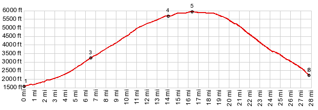
1.(00.0m,1570ft)START-END WEST-1: FR2028 branches of US95 in Salmon River Canyon
2.(03.3m,2090ft)jct with FR463 on right
3.(06.5m,3230ft)jct with Fosket Grade Rd on left
4.(14.0m,5690ft)Shell's Lick intersection
5.(16.5m,5960ft)TOP
6.(27.8m,2090ft)START-END WEST-2: same as point2
|