| |
|
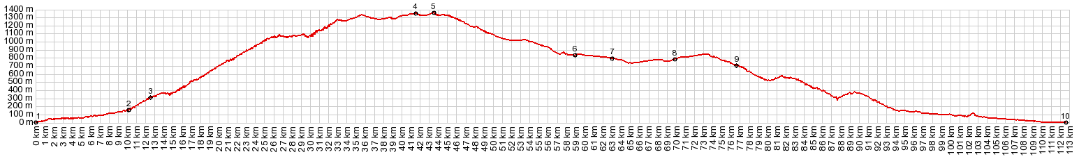
01.(00.0km,0020m) START-END EAST:Almunecar on the beach
02.(10.1km,0160m)turnoff to Alto de Itr_abo is on the right
03.(12.5km,0300m)Otivar, turnoff to Lentegi comes just after this
04.(14.6km,1350m)paved turnoff to Iayena on top of forested plateau on left
05.(43.8km,1360m)TOP point of highest elevation
06.(58.9km,0850m)profile crosses A44; north goes to Puerto Suspiro del Moro and Granada. But profile turns south
07.(63.1km,0800m)profile skirts El Padul
08.(75.6km,0760m)road skirts El Durcal
09.(76.8km,710m)right goes to Restabal
10.(112.7km,020m)the coast, just east of Salobrena
|