| |
|
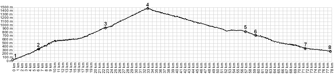
1.(40m,00.0km) START-END
EAST: jct D81 - D84, east of Porto, at bridge over Riviere
de Porto
2.(330m,06.2km) upper turnoff to Ota on D124 is on left
3.(924m,22.5km) right on D70 goes to Col de Sevi, profile
stays left
4.(1467m,32.8km) TOP: Col de Vergio
5.(820m,56.8km) Caluccia and its lake on the right
6.(730m,59.3km)turnoff on left detours up Corscia
7.(350m,71.6km)START-END WEST ALT: turnoff on left goes to
Col d'Arbitro. Next right goes to Castirla
8.(285m,77.6) START-END WEST: N193 - D84, north of Corte