| |
|
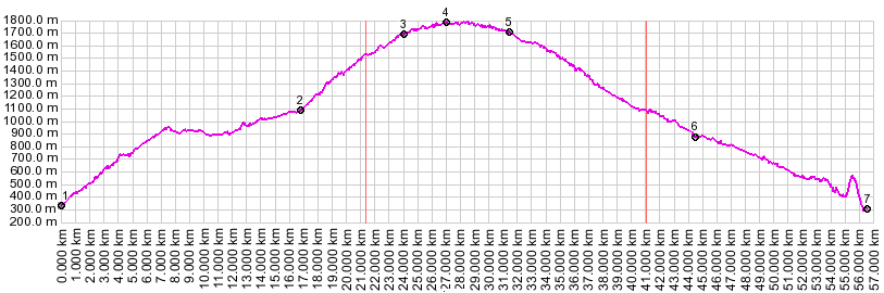
1.(00.0km,364m) START-END WEST: jct bikepath east of Prato al'Isarco - road to San Cipriano
2.(16.8km,1116m) San Cipriano
3.(23.5km,1688m) Nigerpass
4.(29.3km,1774m) TOP: point of highest altitude
5.(30.9km,1694m) Nigerpass joins Karerpass road, continues right, downhill
6.(43.8km,885m) Birchabruck
7.(55.7km,382m) START-END EAST: bike path through Karneid.
spike in profile between km 55 and 56 is due to a tunnel
| |