| |
|
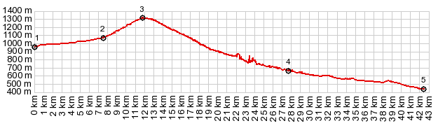
1.(00.0km.1000m)START-END EAST: low point
on D1075, crossing La Buech
2.(07.6km,1070m)profile goes left,road straight ahead
continues to Col du Croix Haute.
3.(11.9km,1318m)TOP: Col de Grimone
4.(27.6km,0680m)beginning of canyon section at jct with
road to Boulc
5.(42.4km,0450m)START-END WEST: jct with D93, south of
Die
|