| |
|
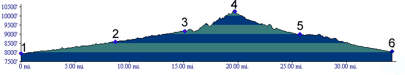
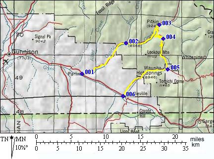
1.(7950ft,mile00) START-END WEST: Parlin
2.(8590ft,mile09) Ohio City ( neither in Ohio nor a city )
3.(9180ft,mile16) southern end of Pitkin. Route turns left and returns in the same direction that it arrived but on the east side of Quartz creek.
4.(10303ft,mile20) TOP: Waunita Pass
5.(8990ft,mile26) START-END ALTERNATE EAST: Waunita Park, turn right for Waunita Hot Springs and to continue along the profile. Left leads to Black Sage Pass.
6.(8060ft,mile35) START-END EAST: junction with US50 near Doyleville