| |
|
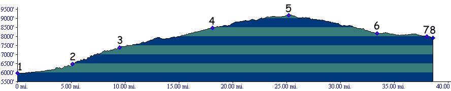
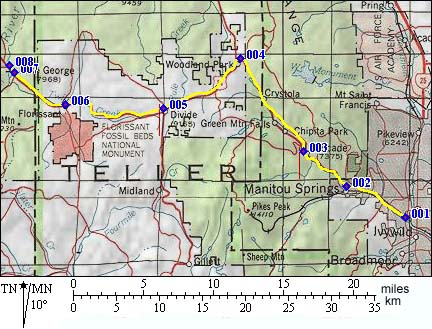
1. (mile00,5960ft) START-END EAST: Colorado Springs, Intersection of I25 and Fountain Creek
2. (mile05,6450ft) START-END ALTERNATE EAST: Manitou Springs is on left
3. (mile09, 7380ft) turnoff to Pike's Peak Highway is on left
4. (mile18, 8470ft) town of Woodland Park
5. (mile25,9184ft) TOP: UTE PASS turnoff to Cripple Creek and Hoosier Pass is on left
6. (mile33,8170ft) Florissant
7. (mile38, 8000ft) Lake George
8. (mile38, 7920ft) START-END WEST: South Platte bridge, west of Lake George