| |
|
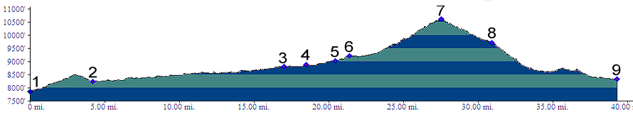
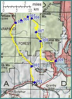
1.(7840ft,mile00) START-END WEST: junction US40 - Co125, west of Granby
2.(8250ft,mile05) low point on Co125
3.(8800ft,mile17) profile turns right onto unpaved road, following Willlow Creek
4.(8870ft,mile19) stay left at fork
5.(9030ft,mile21) stay right at fork
6.(9210ft,mile22) stay right at fork, right after another double track trail joined from hard left.
7.(10620ft,mile28) TOP: Stillwater Pass
8.(9720ft,mile31) profile follows low route following Trail Creek at next two intersections. Staying left here also leads to Lake Granby.
9.(8320ft,mile40) START-END EAST: junction forest road and Co34, at Ranger Station Fish Bay on Lake Granby