| |
|
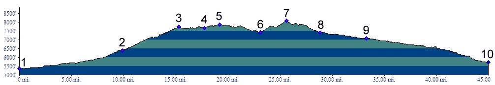
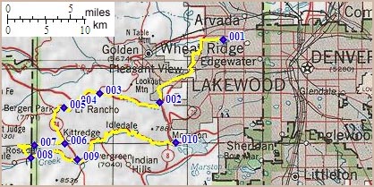
01.(5360ft,mile00) START-END NORTH: Clear Creek bike path at Kipling Ave.
02.(6400ft,mile10) turn from US40 right onto Mount Vernon Canyon, I70 service road
03.(7740ft,mile16) get onto shoulder of I70
04.(7670ft,mile18) exit I70 to Bergen Park and Evergreen Parkway.
05.(7860ft,mile20) Co74 shoulder summit: Bergen Park
06.(7420ft,mile24) turn right onto Stagecoach Road
07.(8100ft,mile26) TOP
08.(7400ft,mile29) turn left onto Upper Bear Creek Road
09.(7080ft,mile34) Evergreen
10.(5720ft,mile45) START-END SOUTH: Morrison, jct C470 - Bear Creek Canyon