| |
|
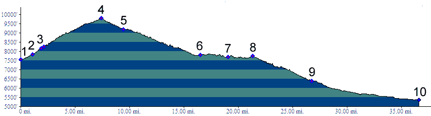
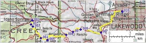
mile00,7540ft) START - END WEST: jct Miner's Ave - Soda Creek Rd, Idaho Springs
02.(mile02,7823ft) turn left onto little Bear dirt road past hot springs.
03.(mile03,8160ft) old Little Bear Creek Road stays straight. Profile goes up switchbacks on better road.
04.(mile08,9800ft) TOP: Squaw Pass. profile turns left
05.(mile10,9190ft) Witter Gulch on right (dirt) connects with upper Bear Creek Canyon; another trail on left
06.(mile17,7800ft) START - END EAST ALT: town of Bergen Park
07.(mile20,7690ft) join I70 at El Rancho
08.(mile22,7740ft) exit I70 for Genessee and Mount Vernon Canyon
09.(mile27,6400ft) turn left from Mount Vernon Canyon onto Colfax Aver
10.(mile37,5360ft) START-END EAST: jct Clear Creek bikepath - Kipling Ave, Wheat Ridge