| |
|
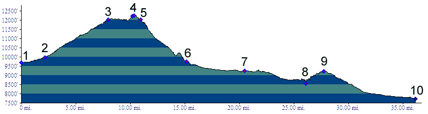
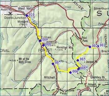
01.(9700ft,mile00) START-END NORTH: Copper Mountain turnoff from Co91
02.(9980ft,mile03) profile continues on Colorado Trail turnoff on right of Vail Bike Path
03.(12020ft,mile08) Searle Pass
04.(12270ft,mile10) TOP: point of highest altitude
05.(12022ft,mile11) Kokomo Pass, profile continues right
06.(9740ft,mile15) trail terminates on dirt road, continue right
07.(9240ft,mile21) START-END SOUTH ALTERNATE: Camp Hale, junction with Tennessee Pass road
08.(8560ft,mile27) intermediate low point
09.(9267ft,mile28) Battle Hill Summit
10.(7730ft,mile35) START-END SOUTH: Dowd Junction