| |
|
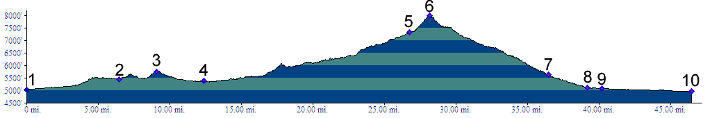
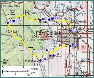
01.(5040ft,mile00) START-END WEST: Fort Collins, jct US287 - West Horsetooth Road
02.(5450ft,mile07) Horsetooth Heights, on the south end of Horsetooth Reservoir
03.(5752ft,mile09) intermediate top
04.(5380ft,mile13) Masonville; profile continues straight
05.(7326ft,mile27) Stove Prarie; profile turns right up Rist Canyon Road
06.(8000ft,mile29) TOP: Rist Canyon summit(u)
07.(5630ft,mile37) Cloudy Pass is on the divide south of this point
08.(5120ft,mile39) Bellvue
09.(5080ft,mile41) jct Co28-US287; profile continues on US287 to Fort Collins
10.(4980ft,mile47) START-END EAST: Fort Collins, jct US287 - Co14