| |
|
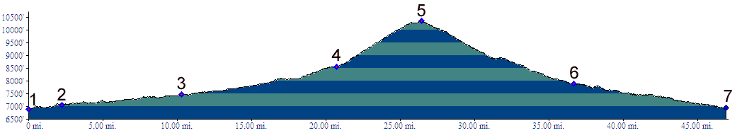
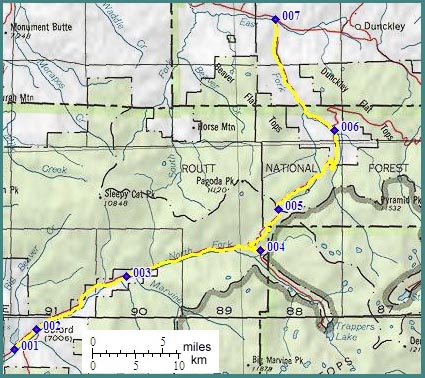
1.(6900ft,mile00) START-END WEST ALTERNATE: lower junction with Buford - New Castle Roald
2.(7060ft,mile03) START-END WEST: upper junction with Buford - New Castle Road in Buford.
3.(7070ft,mile11) road on right goes to Marvine Creek campground
4.(8558ft,mile21) road on right goes to Trapper Lake
5.(10343ft,mile27) TOP: Ripple Creek Pass
6.(7880ft,mile37) START-END EAST: junction with road to Dunkley Pass on right. Profile continues downstream on left.
7.(6960ft,mile47) junction with Willow Creek Road.