| |
|
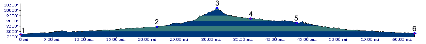
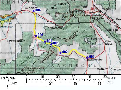
1.(7720ft,mile00) START-END EAST: Saguache
2.(8450ft,mile22) START-END ALTERNATE EAST: turnoff to Rabbit Canyon and Cochetopa Pass is on left.
3.(10149,mile31) TOP: North Cochetopa Pass
4.(9230ft,mile36) turnoff to Saguache Park is on left
5.(8810ft,mile44) START-END WEST: junction with Cochetopa Pass road is on left. Road enters Cochetopa Canyon
6.(7830ft.mile62) START-END ALTERNATE WEST: junction with US50