| |
|
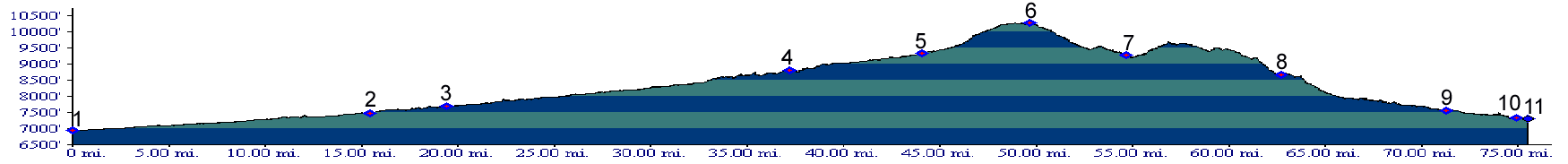
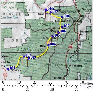
01.(6930ft,mile00) START-END SOUTH: Dolores
02.(7480ft,mile16) Stoner
03.(7690ft,mile20) Taylor Creek dirt road leaves on left
04.(8820ft,mile38) START-END SOUTH ALTERNATE: Rico
05.(9340ft,mile45) Dunton road joins from left
06.(10222ft,mile50) TOP: Lizard Head Pass
07.(9270ft,mile55) turnoff at Ophir Loop to Ophir Pass is on right
08.(8670ft,mile63) START-END NORTH ALTERNATE: Telluride is to the right at this T. Profile continues to left
09.(7550ft,mile72) Sawpit
10.(7320ft,mile75) Placerville
11.(7300ft,mile76) START-END NORTH: junction with Co62 and Dallas Divide Profile