| |
|
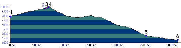
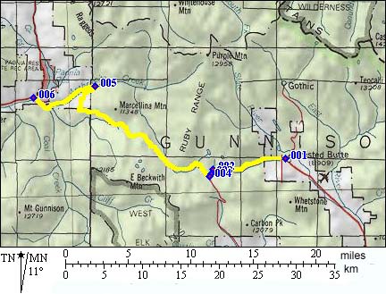
1.(mile00,8914ft) START-FINISH EAST : Crested Butte
2.(mile06,8938ft) jeep trail turnoff to Ruby Lake is on right
3.(mile07,9906ft) dirt road turnoff to Ohio Pass is on left, stay right
4.(mile07,10000ft) TOP: Kebler Pass, Irwin town site cemetary is near here on right
5.(mile25,6767ft) road crosses Anthracite Creek, dark Canyon trail begins here, road is paved for a short distance
6.(mile31,6311ft) START-FINISH WEST : Kebler Pass road joins Mc Lure Pass road