| |
|
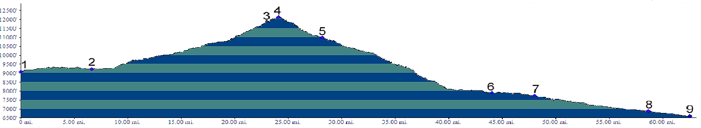
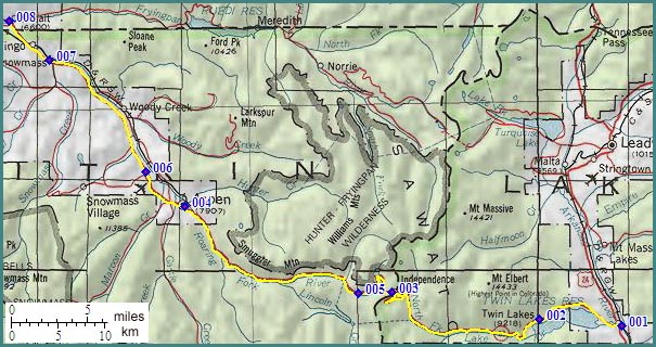
1.(9083ft,mile00) START-END EAST ALTERNATE: Balltown
2.(9238ft,mile06) START-END EAST town of Twin Lakes
4.(12095ft,mile24) TOP: Independence Pass
5.(10972ft,mile28) ghost town Independence is south of road
6.(7902ft,mile44) START-END WEST: Aspen
7.(7714ft,mile48) Aspen airport
8.(6886ft,mile59) Snowmass, road on left goes to Snowmass resort and Watson Divide. Right over birdge connects to Rio Grande Trail.
9.(6606ft,mile63) START-END ALTERNATE WEST: Basalt