| |
|
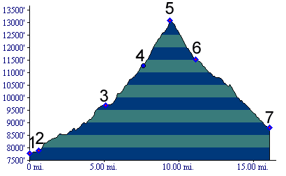
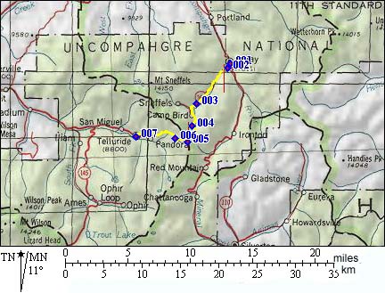
1.(7787ft,mile00) START-END NORTH: downtown Ouray
2.(7860ft,mile) take Canyon Creek dirt road on right
3.(9707ft,mile) stay right towards Camp Bird
4.(11276ft,mile) site of Upper Camp Bird, take steep
trail up mountain to right
5.(13114ft,mile) TOP: Imogene Pass
6.(11527ft,mile) Tomboy Mine ruins
7.(8800ft,mile) START-END SOUTH: downtown Telluride