| |
|
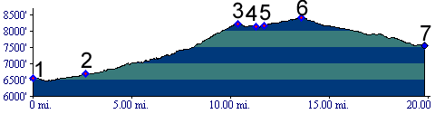
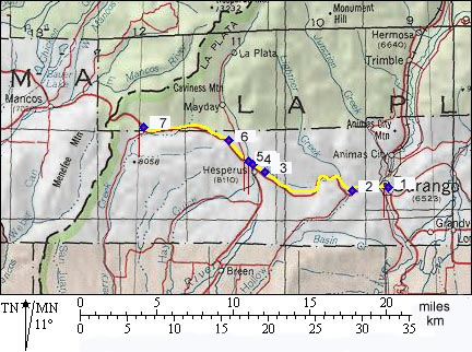
1.(6550ft,mile00) START-END EAST:
Durango
2.(6680ft,mile03) Wildcat Canyon road leaves on left. Profile continues straight.
3.(8213ft,mile11) Hesperus Pass
4.(8130ft,mile12) settlement of Hesperus; Co140 leaves on left.
5.(8167ft,mile12) road to La Plata Canyon and Kenebec Pass leaves on right.
6.(8413ft,mile14) TOP: high point
7.(7560ft.mile20) START-END WEST: junction with Cherry Creek (dirt) road.