| |
|
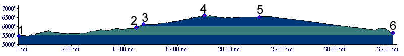
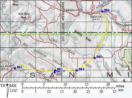
1.(5470ft,mile00) START-WEST: West: Slick Rock Bridge; Co141 crosses the Dolores River
2.(5940ft,mile11) One of several dirt road roads joining from Disappointment Valley to the right. Lone Cone SWA summit(u) profile connects here.
3.(6125ft,mile12) Gypsum Pass
4.(6610ft,mile13) TOP: high point, dirt road leaves towards left
5.(6520ft,mile23) START-END ALTERNATE EAST: settlement of Basin is to the right.
6.(5630ft,mile36) START-END EAST: junction with Co145