| |
|
-
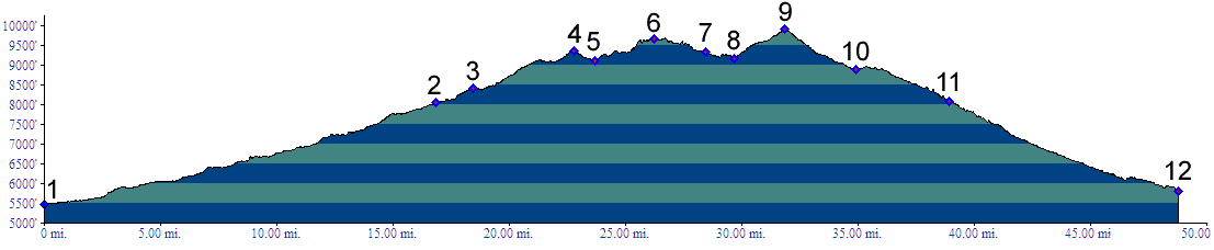
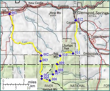
01.(5470ft,mile00) START-END WEST: jct: Divide Creek road - county road on south side of Colorado River, 5 miles west of New Castle
02.(8050ft,mile17) jct with Road Gulch on left
03.(8410ft,mile19) jct with road to Coal Ridge on right
04.(9370ft,mile24) intermediate high point
05.(9120ft,mile25) intermediate low point
06.(9670ft,mile27) FR812 ends. FR300 begins. FR302 over Hastack Gate leaves on left. Immediately afterwards FR800 descends to West Divide Creek or right. Profile follows FR300.
07.(9330ft,mile29) FR302 rejoins FR300 on left
08.(9200ft,mile31) intermediate low point
09.(9900ft,mile33) TOP
10.(8880ft,mle35) route through Road Gulch and Fourmile Park rejoins route on left
11.(8070ft,mile39) jct with paved road to Sunlight Ski area
12.(5800ft,mile44) START-END EAST: bridge over Roaring Fork River, south end of Glenwood Springs
-