| |
|
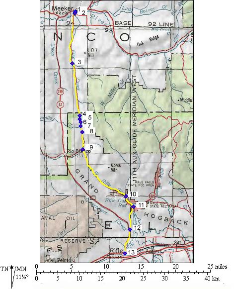
01.(6210ft,mile00) START-END NORTH: downtown Meeker, Golf Club road leaves towards south.
02.(6210ft,mile01) take right
03.(6800ft,mile08) stay right in valley
04.(8148ft,mile16) first summit
05.(7910ft,mile17) junction with Thirteen Mile Creek
06.(8153ft,mile17) TOP: second summit, Dick Pass
07.(7906ft,mile18) junction with Fourteen Mile Creek
08.(8124ft,mile19) third summit
09.(7600ft,mile22) dirt road connecting with Co13 and leaves on right
10.(6080ft,mile31) road up Middle Rifle Creek and prison leaves on left
11.(6080ft,mile33) route becomes paved. Continue on right through Rifle Gap
12.(5580ft,mile37) junction with Co13. Profile continues to Rifle on left.
13.(5290ft,mile41) START-END SOUTH: Rifle