| |
|
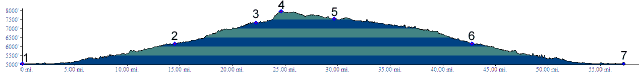
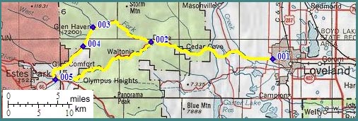
1.(5340ft,mile00) START-END EAST: Loveland, US34 south of Rist Benson reservoir
2.(6170ft,mile) Drake; profile goes right up Devil's Gulch
3.(7330ft,mile) Glenn Haven
4.(7980ft,mile) TOP
5.(7550ft,mile) Estes Park; profile continues left on US34 down Big Thompson Canyon.
6.(6170ft,mile) same as 2
7.(5340ft,mile) same as 1