| |
|
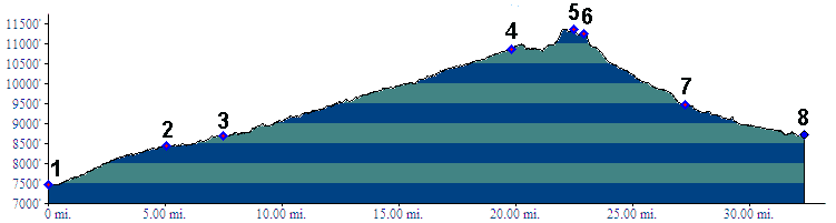
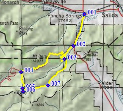
1.(7490ft,mile00) START-END 1 ALT: jct US50 - US285,
Poncha Springs
2.(8440ft,mile06) profile turns right onto Marshall Pass
Rd
3.(8700ft,mile08) START-END 1: route continues on CR200,
still following Poncha Creek, near Shirley trailhead
4.(10846ft,mile20) Marshall Pass
5.(11350ft,mile23) TOP: point of highest altitude
6.(11240ft,mile24) profile turns off Colorado Trail, left
down Silver Creek Trail
7.(9460ft,mile28) jct with Toll Road Gulch on right
8.(8700ft,mile33) START-END 2: same as point 3 - Shirley
Trailhead