| |
|
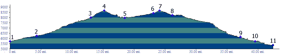
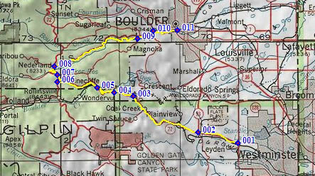
01.(5730ft,mile00) START-END SOUTH: intersection of Co72 and Indiana Road, Arvada. Route follows Co72.
02.(6240ft,mile05) START-END ALTERNATE SOUTH: Co72 intersects Co93
03.(8000ft,mile13) village of Crescent, marked by a liquor store. Dirt road leaves on right for Gross Reservoir.
04.(8680ft,mile16) TOP: development of Wondervu
05.(7980ft,mile19) START-END NORTH: lowpoint on western side, town of Pinecliffe (no facilities)
06.(8420ft,mile23) Co72 ends at Peak to Peak Hiway. Profile turns right
07.(8660ft,mile25) Peak to Peak Highway m26.6 summit(u), Magnolia Road joins on right
08.(8230ft,mile27) Route turns right, away from Peak to Peak Highway down Boulder Canyon
09.(6150ft,mile37) Bummer's Gulch joins on left
10.(5730ft,mile40) Road following Four Mile Gulch joins on left
11.(5350ft,mile43) START-END NORTH ALTERNATE: Boulder, jct Co119 - Broadway