| |
|
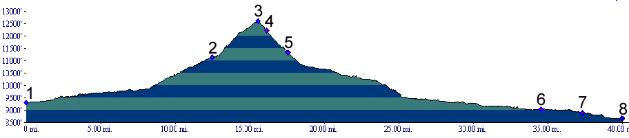
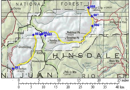
01.(9300ft,mile00) START-END WEST: Silverton
02.(11140ft,mile13) Animas Forks, Cinnamon Pass takes
off on right
03.(12620ft,mile16) TOP: Cinnamon Pass
04.(12240ft,mile16) profile takes right fork. Both forks
converge.
05.(11320ft,mile18) continue left downvalley
06.(9030ft,mile35) Lake San Cristobal
07.(8880ft,mile38) route joins Co149
08.(8660ft,mile40) START-END WEST: Lake City