| |
|
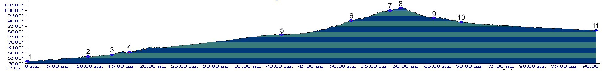
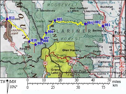
1.(5230ft,mile00) START-END EAST: Ted's Place gas station at junction of US287 and Co14
2.(5610ft,mile10) START-END EAST ALTERNATE settlement of Poudre Park
3.(5860ft,mile14) Mishiwaka (bar and lounge) little narrows are between here and point 4
4.(6100ft,mile16) turnoff to Prarie Stove and Windy Pass is on left. Big Narrows are upstream of here.
5.(7720ft,mile41) Kinnikinnik (cabins)
6.(9040ft,mile52) turnoff towards Wyoming is on right, just before Chambers Lake
7.(9980ft,mile58) turnoff to Montgomery Pass trail is on right
8.(10276ft,mile60) TOP: Cameron Pass
9.(9300ft,mile65) turnoff to western approach of Montgomery Pass is on right
10.(8910ft,mile69) START-END WEST settlement of Gould
11.(8140ft,mile90) START-END WEST ALTERNATE: Walden
 |