| |
|
-
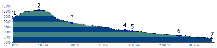
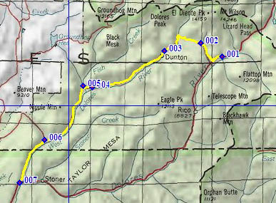
1.(9330ft,mile00) START-END EAST: CR535 turns off Co149, south of Lizard Head Pass
2.(10130ft,mile05) TOP
3.(8880ft,mile10) Dunton Guard Station
4.(8180ft,mile19) junction with forest road to Willow Divide on right. Pavement starts approximately here
5.(8090ft,mile20) junction with forest road following Fish Creek on right
6.(7660ft,mile28) junction with forest road following Cottonwood Creek on right
7.(7390ft,mile33) START-END WEST: junction CR535 - Co149, south of Stoner
-