| |
|
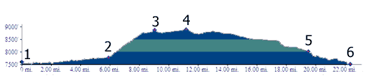
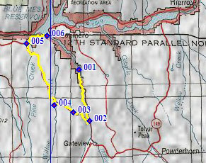
1.(7520ft,mile00) START-END SOUTH: end of foot trail on Lake Fork Road
2.(7770ft,mile06) profile turns right up hill
3.(8870ft,mile09) intermediate top
4.(8900ft,mile12)TOP
5.(8010ft,mile20) CR25 ends on US50. Profile turns right
6.(7520ft,mile23) START-END NORTH: US 50 crosses flooded bay of Lake Fork