| |
|
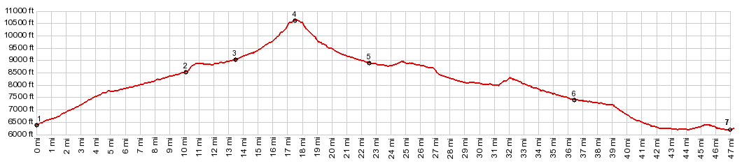
1.(mile00.0,6370ft) START-END EAST: jct US50 - CR12 in Cotopaxi on the Arkansas River
2.(mile10.1,8520ft)profile turns left from CR12 onto CR16
3.(mile13.5,9020fit)route turns left onto rougher Waugh Mtn Rd
4.(mile17.7,10620ft)TOP: CR169 WaughMtn s(u)
5.(mile22.6,8900ft)jct with CR2; profile turns right
6.(mile36.5,7410ft)profile turns right on Co9 towards Canyon City
7.(mile46.9,6170ft) START-END WEST: jct Co9 - US50, west of Canyon City
| |