| |
|
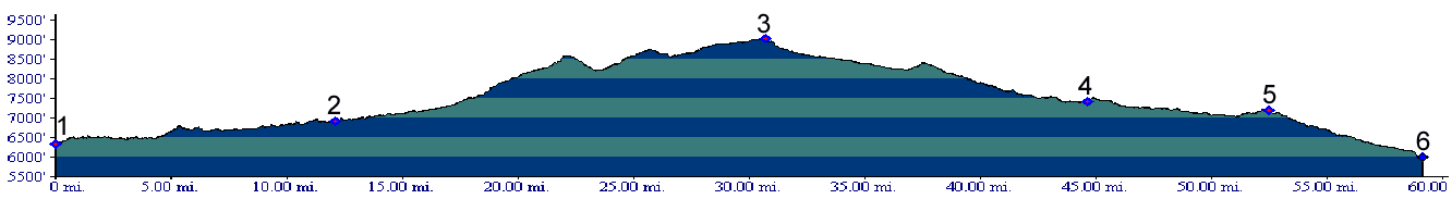
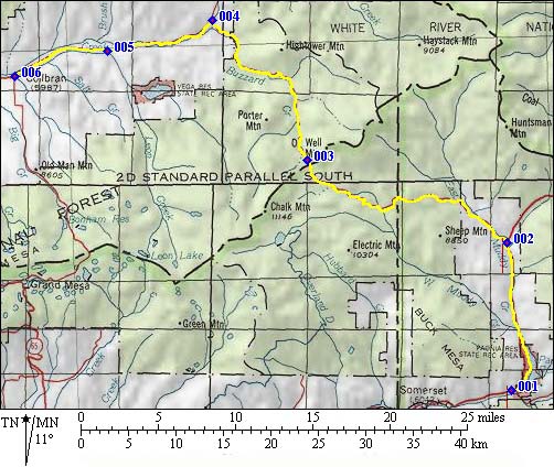
1.(6320ft,mile00) START-END SOUTH: Paonia Reservoir, junction between Mc Lure Pass road and Kebler Pass road.
2.(6910ft,mile12) START-END ALTERNATE SOUTH: go left on rd245 rd to Buzzard Pass
3.(9013ft,mile31) TOP: Buzzard Pass
4.(7413ft,mile45) profile continues left to Colbran. Right goes to Alkali Creek - Road Gulch divide (u) towards Silt.
5.(7180ft,mile53) continue left to Colbran
6.(6000ft,mile59) START-END NORTH: Colbran