| |
|
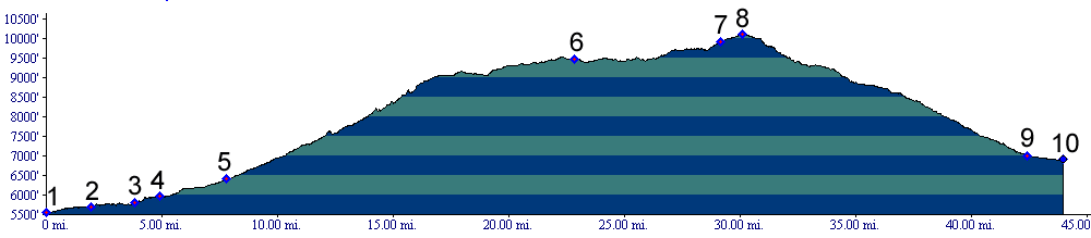
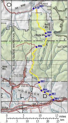
01.(5560ft,mile00) START-END SOUTH: New Castle, turn up Grass Valley road, heading north on the west end of town.
02.(5700ft,mile02) road following East Elk Creek leaves on right, stay left.
03.(5800ft,mile04) road following Main Elk Creek leaves on right, stay left
04.(5910ft,mile05) New Castle - Buford road leaves on right, go right.
05.(6410ft,mile08) left goes back to Harvey Gap summit(u); stay straight
06.(9470ft,mile24) Triangle Park area; left fork descends towards Rifle; stay right
07.(9900ft,mile30) right leads to Meadow Lake campground; stay straight
08.(10097ft,mile30) TOP: Buford - New Castle Road summit(u)
09.(6990ft,mile43) START-END NORTH: continuing straight leads to Buford. But profile continues left towards Meeker.
10.(6910ft,mile44) START-END NORTH ALTERNATE: bridge across White River. Left leads to Meeker, right to Buford.