| |
|

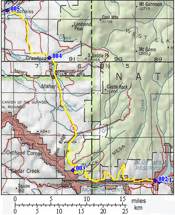
1.(7700ft,mile00) START-END SOUTH: junction US50 and
Co92, west of Sapinero
2.(7600ft,mile01) low point on south side: bridge over
Gunnison River
3.(9121ft,mile23) TOP: a viewpoint with a gazebo marks
the top. Road no longer follows rim from here on.
4.(6560ft,mile43) Crawford
5.(5320ft,mile53) START-END NORTH: Hotchkiss