 |
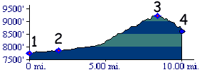
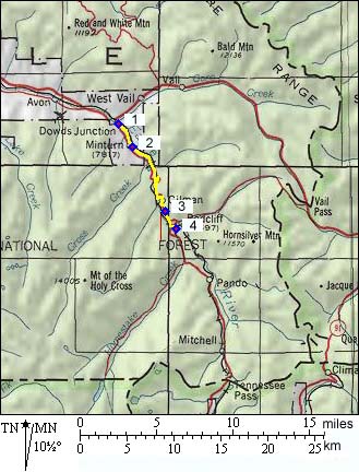
1.(7731ft,mile00) START-END
NORTH: Dowds Junction, connects with Vail
Pass profile
2.(7841ft,mile02) town of Minturn
3.(9267ft,mile08) TOP: Battle Mountain
Summit
4.(8562ft,mile10) START-END SOUTH: go left
into Redcliff and Shrine Pass profile or
straight to Tennessee Pass |
|
 |