Mirador Cabra Montes(sh) The south side of the Carretera de la
Chaba from Almunecar is much more
spectacular than the Granada side, as well as
more challenging for the racing types, which are
plentiful on this road. Consequently there are
established points where bike racers often turn
around to go back down the south side. One of
them is the Mirador Cabra Montes. At this point,
most but not all of the climbing is below, but
the most spectacular section of the Carretera de
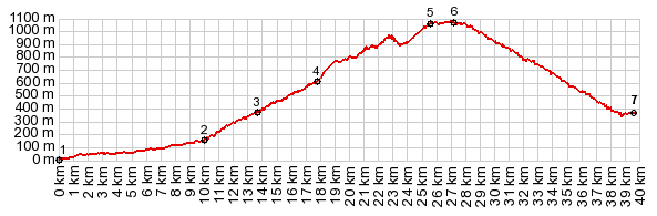
la Chaba is still above this point. But with the help of an unpaved
track you can also make this point the highest
point of a loop ride, which starts in a town
that is glued to the hillside, Otivar. That is
what the profile shows below.
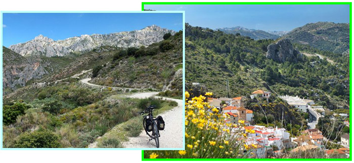
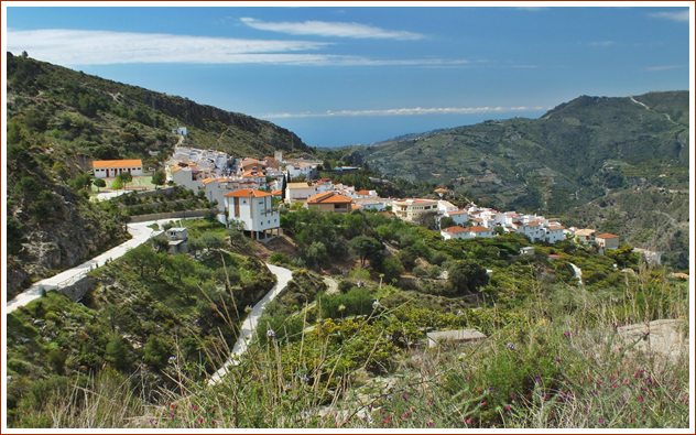
Several unpaved or concrete tracks leave from the
village Lenteji. The one I happened to take is the
most northerly, and it connects back to the
Carretera de la Chaba. The others cross the ridge
to the west, and then pick up one of the paved
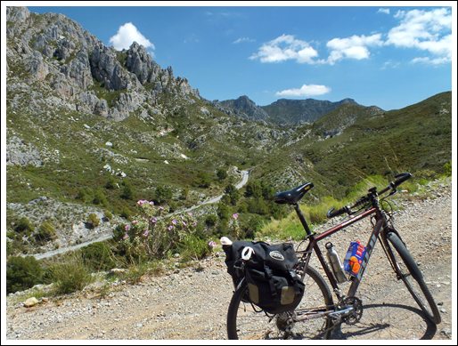
roads above the Rio Guadalfeo. Back to the profiled route: From above Lenteji a
fairly good dirt road continues to traverse up
into the hills. It heads for an unnamed pass to
the left of the inspiring limestone spires ahead. Near the top I meet a group of hikers. They are
on vacation, an in a vacation mood. "Contador -
Contador" they call down to me, in order that I
might climb harder. How nice of them - I look
nothing like Contador, and I ride nothing
like him. But I have seen the bike racers who
could be mistaken for him back on the Carreterea
de la Chaba. There are many of them training on
that climb, and they would ride circles around me.
The hikers give me a bottle of water and we
exchange basic information, like where we are
from. They are from Belgium. "You have probably
heard of Bruxels by now" one of them thinks out
loud. - Yes I have, cradle of standardized
vegetable shapes, straight cucumbers, nicely
curved bananas and things like that. Also the
reason for Mafiosos like Mario Draghi, who
impoverishe people who save money. One of the
friendly hikers wants to give me a push. I kindly
refuse because I fear I might fall off the bike,
and I am on my way again. Along the way there are signs for the "Ruta
Lenteji - Guardjamos - Barranca Arroba - Carretera
de la Cabra. I finally reach what looked like the
pass from below, located between the limestone
spires. A small sign stuck in the ground like a
"do not spray" sign reads "Tranco Piedra Azaul".
But surprise - this is not the top. A concrete
path descends only to turn sharp left and traverse
up the next ridge. But before I have a chance to
really appreciate the remoteness of this
landscape, the path termintes at the Carretera de
la Chaba. The spot is signed as "Cortijo de
Lizardo". Turning left here, that is back down to Otivar,
the road climbs a little higher and reaches a high
point, immediately before reaching the Mirador
Cabra Montes. This Mirador building looks more
like a vandalized bus stop. There is also a big
dangerous hole in the ground, that one might fall
into while walking around with the eyes glued on
the LCD of a camera. - No I didn't fall into it
this time. But Miradores are really all about
views, including this one, the building is
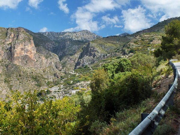
secondary. And the view, given a reasonably
transparent atmosphere, is amazing. The sea 1000
meters below - a blue stripe of paint. Above that
a line of heat generated clouds, that I imagine
must be in Africa. The green hills are dotted with
white spots, every one of them a home with a view.
Terraced hillsides invite comparisons with
Himalayan foothills. There is also a private home
in much better shape immediately next to the
"vandalized bus stop"
From South. (described
downwards). There is more on this side of the
ciimb on the Carretera
de la Chaba s(u) page. The profile connects
back to the north side above Otivar and ends there
PARTIALLY PAVED / UNPAVED ( < Carretera de la Chaba(sh) | Carretera de Gualchos(sh) > ) Mirador Cabra Montes s(u), additonal out and back : above Collado de Itr_abo > Collado de Itr_abo > Otivar > Lenteji > Ruta Lenteji - Guardjamos - Barranca Arroba - Carretera de la Cabra <> out and back on Carretera de la Cabra north a few km before summit point and down a short distance to the west on an unpaved route >> Carretera de la Cabra south > Otivar > back to startign point above Collado de Itr_abo: 42.5miles with 6790ft of climbing in 5:43hrs (Garmin etrex30 r5:16.4.25). |
||||||||||
|
|
advertisement |
|
|
advertisement |