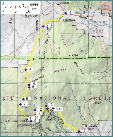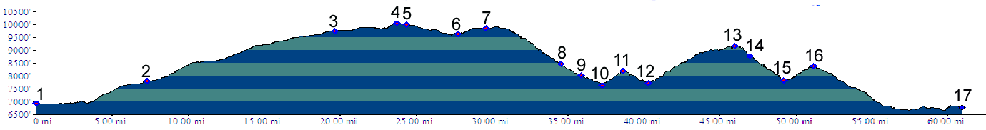
01.(6930ft,mile00) START-END NORTH: junction Posey Lake Road, Ut24, south of
Bicknell
02.(7810ft,mile08) stay left
03.(9750ft,mile20) stay left
04.(10040ft,mile25) TOP: junction with dirt track on left to Willow Bottom
05.(10000ft,mile25) Roundy Lake
06.(9640ft,mile28) road on right goes to Griffin Top; continue straight
07.(9870ft,mile30) Cyclone Lake
08.(8480ft,mile35) stay left
09.(8010ft,mile36) T junction onto Hell's Backbone Road. Profile continues left towards Boulder. Right goes to Escalante.
10.(7650ft,mile38) low point
11.(8190ft,mile39) high point
12.(7730ft,mile41) low point
13.(9160ft,mile46) Hell's Backbone Road summit(u)
14.(8750ft,mile47) Hell's Backbone Bridge
15.(7820ft,mile50) low point
16.(8390ft,mile51) first high point
17.(6770ft,mile61) START-END SOUTH: junction dirt road and Ut12 south of Boulder