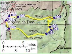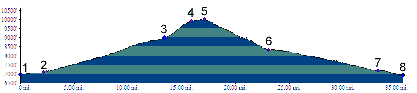
01.(6970ft,mile00) START-END SOUTH: jct NM68-NM518, north of Ranchos de Taos
02.(7100ft,mile03) jct NM518-FR437, south of Talpa
03.(8990ft,mile14) turn left, away from Rio Chiquito valley
04.(9920ft,mile16) FR438 and route from Chosa Pass joins from right
05.(10000ft,mile17) TOP
06.(8330ft,mile23) FR437 ends on US64. Profile turns left to Taos
07.(7190ft,mile33) START-END NORTH: jct NM585 - US64, south east of Taos;
profile continues on NM585
08.(6940ft,mile36) START-END NORTH ALTERNATE: jct NM585 - NM68