elevation profile:
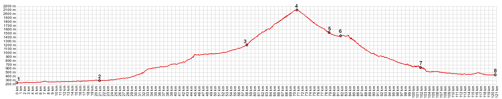
Sankt Gotthard Pass
01.(00.0km,232m) START-END ALTERNATE: Bellinzona
02.(20.7km,299m) Biasca
03.(57.9km,1192m) Airolo. Profile follows bicycle route.
04.(70.5km,2106m) TOP: Sankt Gotthard Pass
05.(78.6km,1546m) Hospental
06.(81.7km,1440m) Andermatt
07.(101.7km,626m) Reuss
08.(120.7km,435m) shore of Vierwaldstaedtersee just north of Fluelen
several spikes in the profile are due to tunnels
View
eu_Sankt_Gotthard_Pass
in a larger map